ADCi and BuildingFootprintUSA: Map Data Solutions for Indoor Spaces
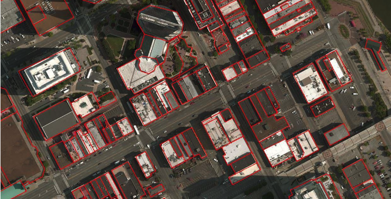
 ADCi is continually seeking opportunities that benefit the customers we serve, and we’re proud to announce that we’re now a reseller of BuildingFootprintUSA Shapes and BuildingFootprintUSA Addresses. This new partnership is key in accessing map data that captures an advanced geospatial layer of nationwide building footprints to accurately locate, analyze, and visualize spaces where people spend the majority of their time — in buildings!
Industries including public sector and governmental entities, utility companies, insurance providers, telecommunication companies, and mobile location/ad technology service suppliers can benefit from the BuildingFootprintUSA data solutions offered through ADCi:
BuildingFootprintUSA Addresses contains four layers:
- Primary layer: A polygon layer containing building footprints with known addresses.
- Secondary layer: A point layer containing comprehensive address information, including secondary addresses and secondary unit addresses.
- No address layer: A polygon layer containing building footprints that have no address information.
- Address points layer: A point layer containing any address point locations that could not be linked to a building footprint.
BuildingFootprintUSA Shapes is meant for applications that don’t need address information — such as visualization of buildings as a backdrop, or analysis with a building layer where an address is not required. The single polygon layer portrays a building footprint. Each region object or feature represents a single building.
BuildingFootprintUSA Addresses and Shapes integrate and aggregate multiple data elements to the building level to enable building-centric analytics. The result? Problem-solving insights that solve critical business challenges. Experience the value and efficiency of these powerful indoor digital mapping tools — and the ADCi partnership with BuildingFootprintUSA — for yourself. Click the button below to download a sample of BuildingFootprintUSA map data now!
Subscribe to ADCi's Blog
Related Posts

How GIS Benefits the Insurance Industry

Location Intelligence: Geospatial Data & Modern Applications

